EFC steers NC breweries to sustainability
Improving water usage in the craft beer industry is the focus of a UNC Environmental Finance Center project.
Topple a paradigm. Uncover the Unknown. Tar Heels ask questions, develop answers, create solutions and discover cures.

Improving water usage in the craft beer industry is the focus of a UNC Environmental Finance Center project.
Medical, dental and other experts work together to support patients with cleft palate and other conditions.
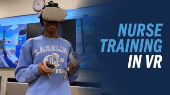
In virtual reality simulations, they learn how to interact with patients in realistic scenarios.
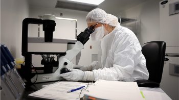
Drs. Gianpietro Dotti and Barbara Savoldo personalize cancer treatments in one of the East Coast’s largest cell therapy facilities.
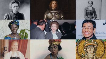
Jan-Benedict Steenkamp’s new book shows how these “gritty women” bent the arc of history.
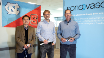
Med-tech startup SonoVascular combines drug-based and mechanical therapies to treat patients with blood clots.

A computer science professor and his student teamed with Microsoft Research to produce breakthrough technology.
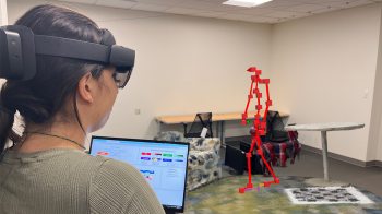
Their software and augmented reality headsets allow clinicians to analyze patient movement and guide physical therapy.