Research at the coast
A team of three Carolina researchers are studying how living shorelines are changing the impacts waves have on the coast so that communities can determine the best ways to better protect their coastal areas.
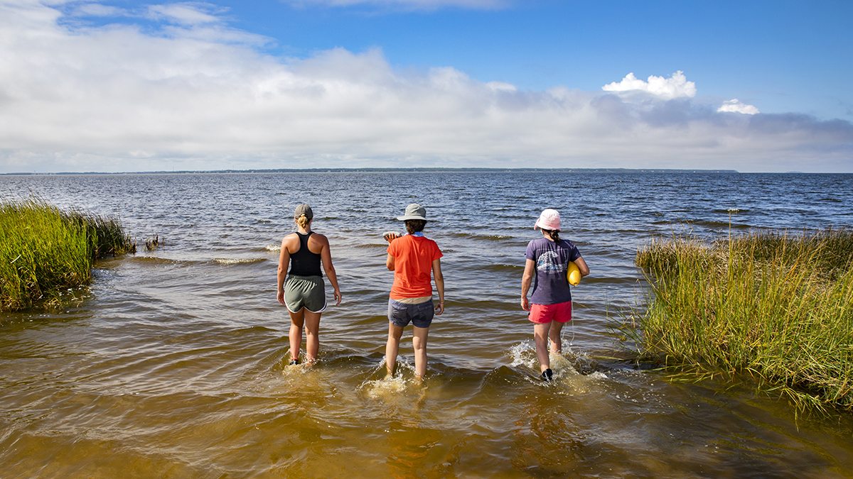
Not all Carolina researchers spend their days in Chapel Hill labs. For some, like associate professor Johanna Rosman, research means heading out to the Outer Banks and getting your feet wet.
Rosman, a physical oceanographer at the UNC Institute of Marine Sciences, and her research team of doctoral student Jana Haddad and junior Joey Carter are taking their work to Jockey’s Ridge State Park in Nags Head, North Carolina, to study how living shorelines are changing the impacts waves have on the coast.
“Living shorelines are nature-based solutions for shoreline protection,” said Haddad, a marine sciences doctoral student. “They’re designed to incorporate both vegetation and constructed elements such as rock or oyster sills.”
The research team traveled to Nags Head from the Institute of Marine Sciences’ home base in Morehead City, North Carolina, in September to take wave measurements from the beach and the water.
“We measure the waves’ heights, their direction and their velocity to try and better understand how they’re being transformed by the living shoreline,” said Haddad. “By using the data that we’re collecting here, we’re hoping to turn a wave model into a simple web tool that anybody can access to predict how waves are dampened by a living shoreline.”
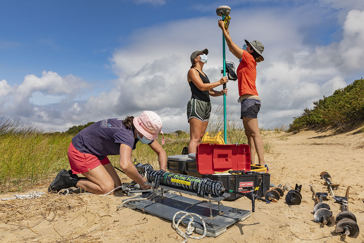
Rosman twisted an anchor that holds a measuring device into the floor of the shoreline. The equipment will collect long-term wave data. Ultimately, the data will examine how waves are being attenuated — or reduced — because of a particular living shoreline design.
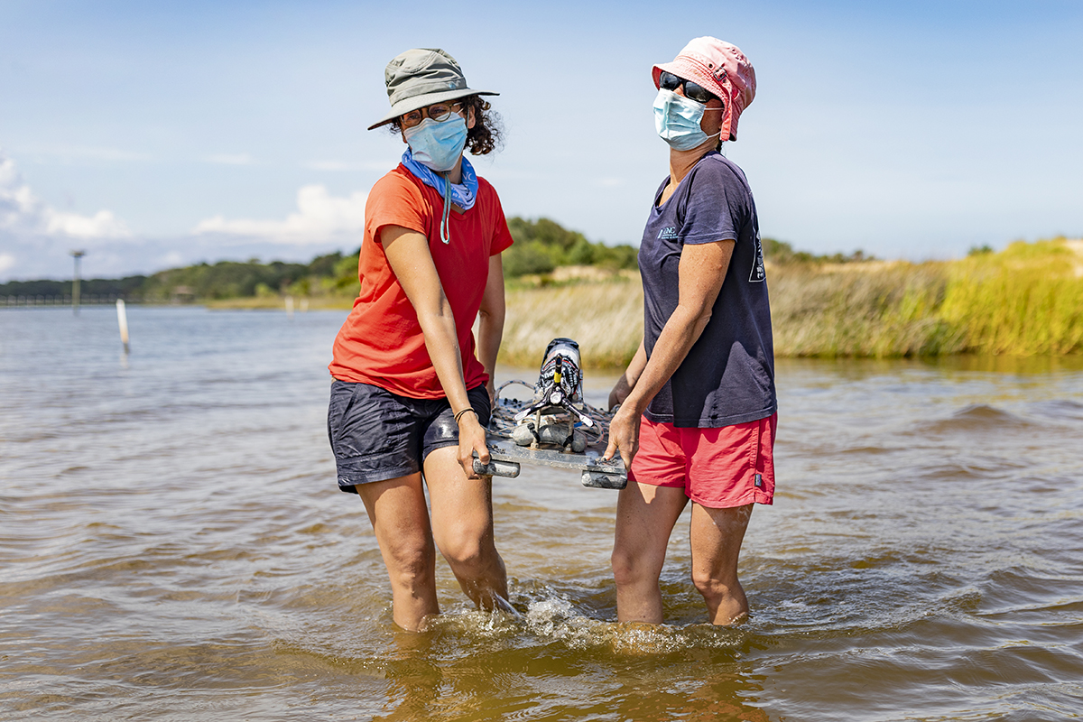
The team also used an acoustic doppler velocimeter to measure the waves’ velocity coming into the living shorelines. By understanding how various living shoreline designs reduce wave sizes, communities can determine the best ways to protect their coastal areas. An effective living shoreline could serve as a critical defense during hurricanes and from sea-level rise.
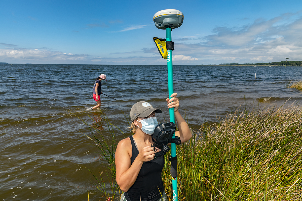
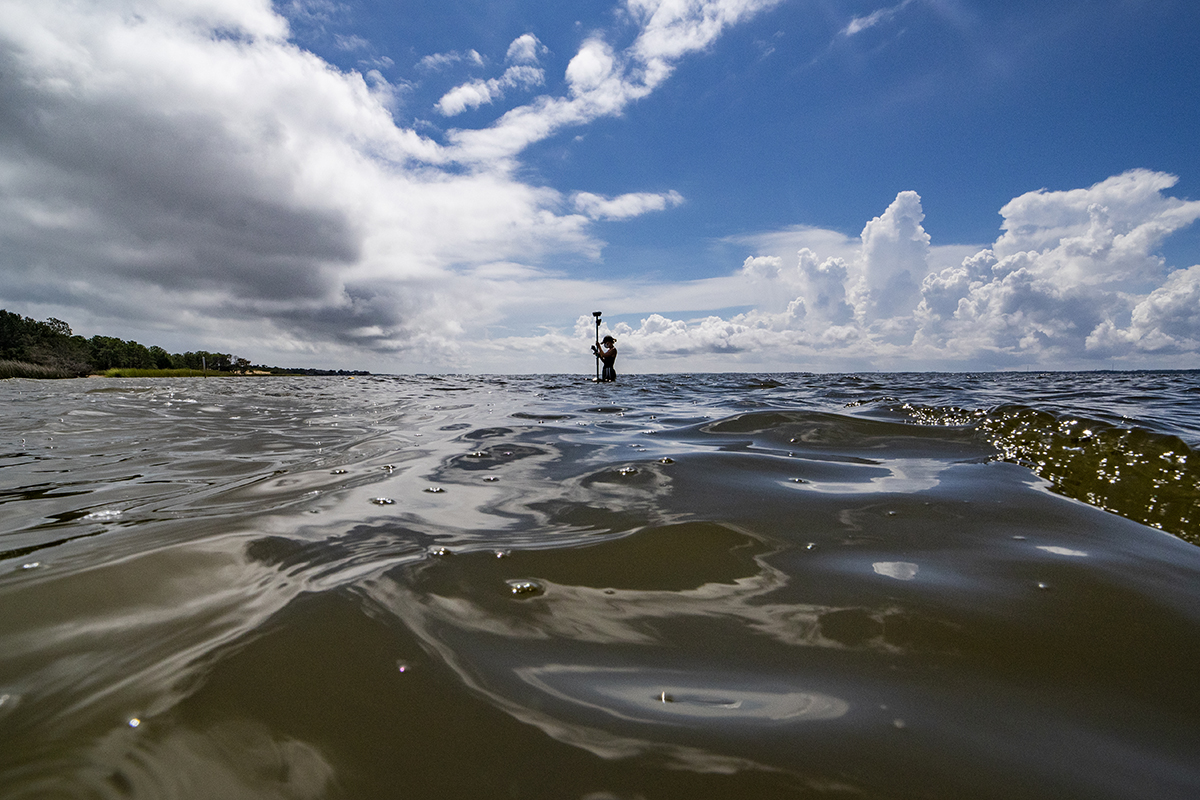
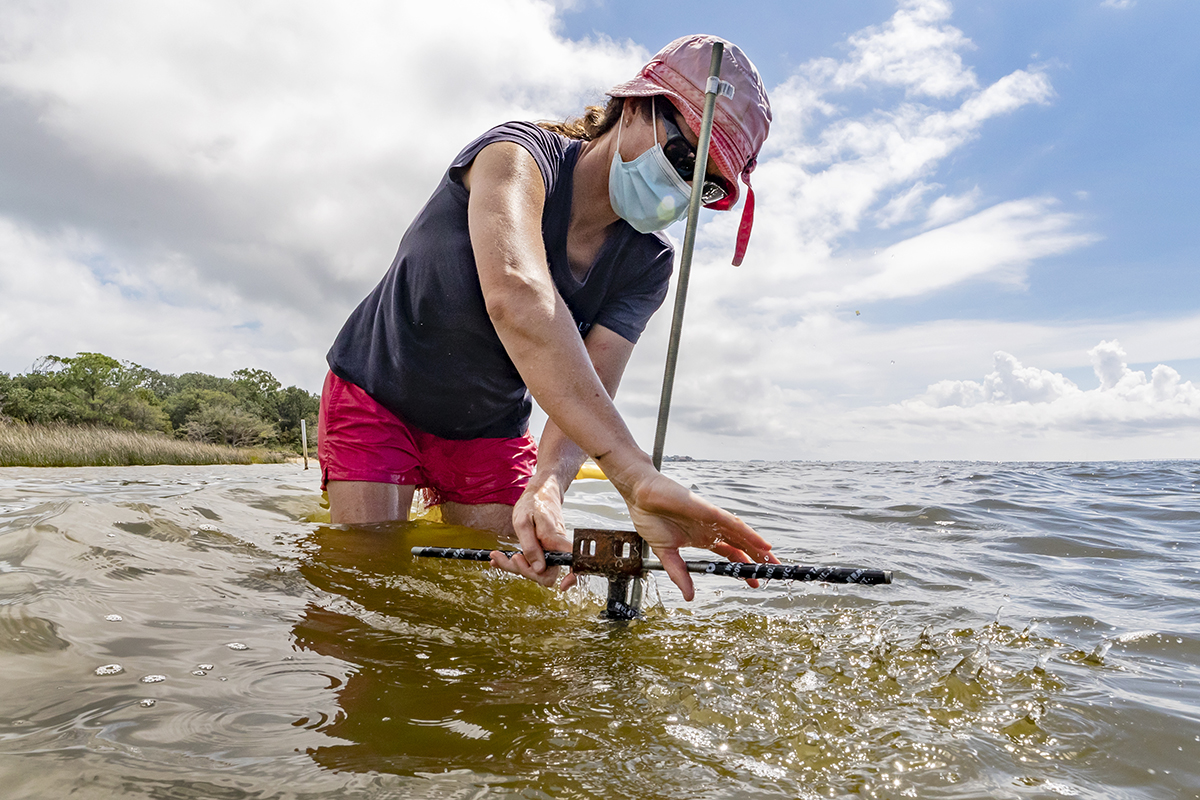
Using a GPS instrument, Carter measures elevation data across the living shoreline to examine how wave reduction varies along different surface slopes on the ocean floor. The junior studying environmental sciences has been working alongside Rosman and Haddad for her undergraduate honors thesis, which will include data the team has collected.
“This research project has been an excellent experience-based learning opportunity that has made me excited about a career in science. Through the project, I’ve gained valuable fieldwork experience and software skills,” Carter said. “Working with Dr. Rosman and Jana Haddad has been really valuable, providing mentorship as I begin thinking about where I see myself after undergrad.”