Why were the earthquakes in Turkey and Syria so devastating?
Carolina geologist Kevin Stewart explains how a strike-slip fault caused the original 7.8 magnitude temblor and its aftershocks.
It would take 10,000 of the magnitude 5.1 earthquakes that hit Sparta, North Carolina, in 2020 to equal the power of the 7.8 magnitude earthquake that hit areas of Turkey and Syria on Feb. 6., Carolina geologist Kevin Stewart said.
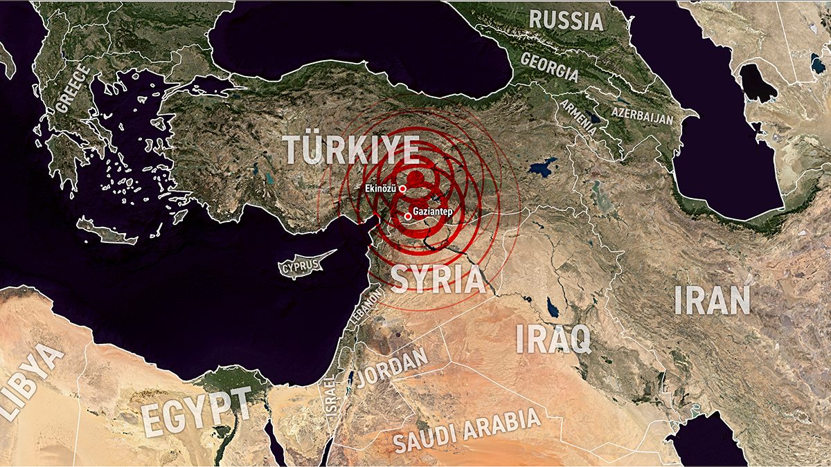
That terrible temblor preceded many aftershocks, including a magnitude 7.5 quake nine hours later and a 6.4 one on Feb. 20. More than 50,000 people have died because of the quakes, with untold infrastructure damage.
Stewart, a professor in the College of Arts and Sciences’ earth, marine and environmental sciences department, said that globally one or two 7.8 earthquakes might occur annually, but they are rare. Quakes nearer 7.0 on the Richter scale occur more regularly. The U.S. Geological Survey reports that four earthquakes of 7.0 or greater besides the two centered in Turkey have already occurred in 2023. The others hit in Indonesia and Vanuatu. In the past decade, dozens of earthquakes 7.0 or higher have happened all over the world from Alaska to Jamaica to China.
Carolina’s Center for Public Service provides recommendations from campus community members on how to support the local Turkish and Syrian communities and contribute to organized aid efforts.
The Well asked Stewart about the recent earthquakes in Turkey and Syria.
We read that a strike-slip movement caused the 7.8 earthquake. What is a strike-slip movement?
Around the world, most big earthquakes happen along tectonic plate boundaries. Tectonic plates move apart from each other at divergent plate boundaries. They come together at convergent boundaries. And they slide past one another, side-by-side, at transform plate boundaries. Transform boundaries are characterized by something called strike-slip faulting, which is faulting that occurs where the two blocks are moving horizontally past each other.

Kevin Stewart
The transform boundary that most people know in the U.S. is the San Andreas Fault, which is a big strike-slip fault in California. In eastern Turkey, a strike-slip fault forms part of a complicated plate boundary where three small plates interact. The 7.8 earthquake occurred along one of these plate boundaries called the East Anatolian Fault. The fault extends on a diagonal line from the Mediterranean Sea roughly 450 miles northeast to the Turkish town of Karlıova. It is a transform plate boundary, and it separates the Arabian Peninsula from Turkey.
In a motion called left-lateral slip, the fault’s west side moved southwest and the east side moved northeast. In photos of roads after the earthquake, you can see evidence of the motion. If you’re driving on a road and come up to the fault trace, you’ll see a break. To continue on the road, you have to move to the left because the road has been displaced by left-lateral slip.
Help us understand the power of a 7.8 earthquake.
The 7.8 earthquake in eastern Turkey is a lot stronger than the 5.1 earthquake over two years ago in Sparta, North Carolina. As we go up 2.7 points in magnitude, that translates to approximately 10,000 times more energy release because of the logarithmic scale. You would need to have 10,000 5.1 magnitude earthquakes to release the same amount of energy as this single 7.8. That gives you an idea of just how powerful that earthquake was.
Unfortunately, lots of people live near active plate boundaries. For instance, the San Andreas Fault runs through the heavily populated San Francisco Peninsula. The strategy in the U.S. is to build infrastructure and buildings that can withstand hard shaking. Past earthquakes in California have shown that we’re pretty successful at this. The areas in Turkey and Syria have a lot of construction that was not able to withstand this level of shaking. I should mention, too, that a magnitude 7.8 earthquake is a really strong earthquake. It’s hard to build buildings that are going to come out of a 7.8 event unscathed.
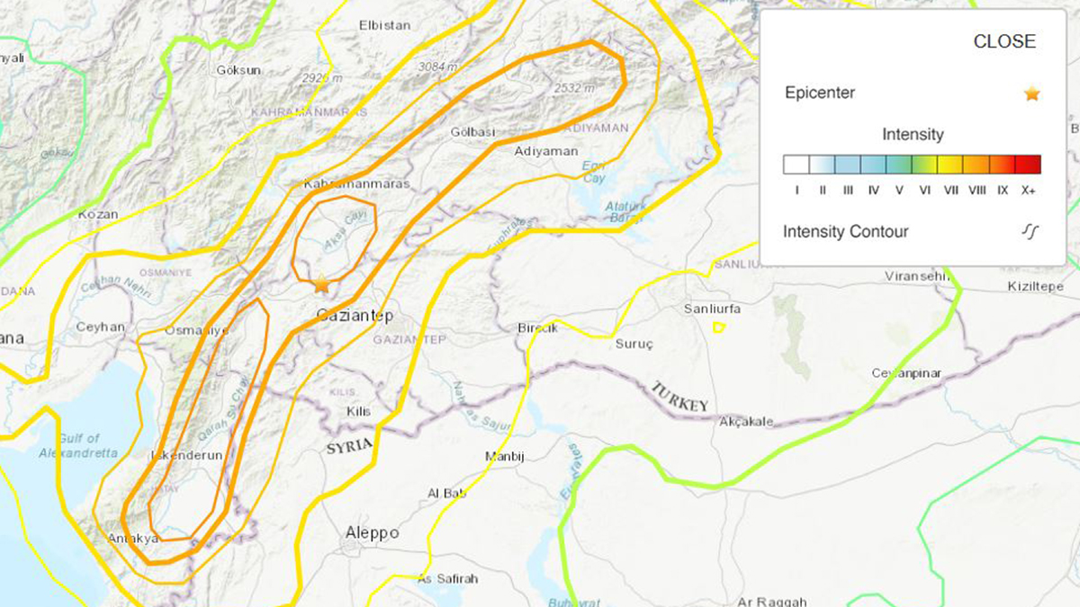
A U.S. Geological Survey map shows the intensity of the 7.8 magnitude earthquake in Turkey and Syria on Feb. 6. The USGS uses the Modified Mercalli Intensity Scale to measure key responses to an earthquake such as people awakening, furniture movement, chimney damage and finally, total destruction. The Mercalli value assigned to a site is designated by Roman numerals to give a meaningful measure of severity. Lower numbers reflect the manner in which people felt the earthquake; higher numbers prioritize structural damage, usually reported by structural engineers.
As the region faces recovery, how can scientists help?
It’s a tough lesson, but these earthquakes teach us a lot about how a particular area is affected by large earthquakes. From this tragedy, the very small silver lining is that we have learned something about the area’s active faults, how the buildings responded, which places suffered more damage, which suffered less damage. That information can be used for future planning and evaluating the seismic risk.